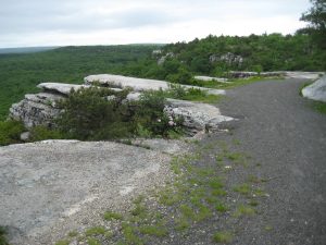
Mountain Bike Lake Minnewaska Carriage Roads, October 2, 9:30AM
It’s hard to beat fall bike riding. The weather is cool and comfortable and the scenery is spectacular. Some of the best rides in the Catskills are found in the scenic farming valleys and around the reservoirs. Many of them are relatively flat or ascend gently towards the head of a valley on dead end roads. These roads are less traveled than most, making them a great place for family rides and for cyclists who are looking to “get away from it all”. Some of our favorites are listed below. Enjoy these great rides at your own pace. (above picture is view from Shavertown Bridge on Pepacton Loop rides.)
Dry Brook Valley – Dry Brook Road runs southeast from SR 28 in Arkville. The climb up this valley with big views of the Dry Brook Ridge is one of the easiest in the Catskills, with just a few somewhat steeper spots that are soon left behind. The one way distance from SR 28 to the Seager Trail parking lot is 8.9 miles. There a several good places to park a car along the route if you prefer a shorter ride, including a large one at the intersection of Todd Mountain Rd.
Rider Hollow – Very near Dry Brook Valley is Rider Hollow Rd. It’s a great short ride on its own at 2.1 miles one way (or 2.5 from the Todd Mountain Rd. parking area.) The two valley rides can easily be combined to create a route of almost 23 miles. Use Todd Mountain Rd. for the connection.
Spruceton Valley – Spruceton Rd. runs east from CR 42 in West Kill. The valley is one of the most scenic in the Catskills with high peaks on both sides of the road. Most of the ride is surprisingly easy, but be prepared for a couple of short but steep climbs. Don’t let that stop you, just dismount and walk up the hill if you want to. It is well worth it. The one way distance to the DEC parking lot at the end of the road is about 7 miles. You can park at the community center in the hamlet of West Kill.
Woodland Valley – Woodland Valley is one of the best known in the Catskills. Located just west of the popular village of Phoenicia, Woodland Valley Rd. leads to a NYSDEC campground just before the end of the road. A deep and narrow valley, Woodland Valley sits at the foot of several of the Catskills High Peaks. The road climbs gently for most of the journey and is not difficult at any point. Park next to the Esopus Creek Bridge at High St. for a 5.4 mile one way ride. To extend the trip, cycle to Phoenicia on High St. or go even farther by crossing the Esopus Creek again on Bridge St. and taking Old Rte. 28 to Mount Tremper for a combined 20 mile ride.
Denver Valley – The Denver Valley in the Town of Roxbury is one of the more off the beaten path destinations on this list. But don’t let that fool you, it’s a popular area anchored by Roxbury Run. Surrounded by many lesser peaks, it leads to the base of Bearpen Mountain, a Catskills High Peak. The route is mostly a gentle one with a few short steeper climbs. From SR 30 in Margaretville travel north to Denver-Vega Rd. (Rte. 36) at Kelly Corners. Turn east and look for a good place to park your car on the side of the road. At Vega Mountain Rd. continue straight on Sally’s Alley to its end. The ride one way is about 9.5 miles.
Beaverkill Valley – The Beaverkill is renowned as a trout fishing stream. The road that follows it to the foot of Balsam Lake Mountain is scenic and gently sloping for most of its length, with a bit of a climb towards the end on a section of road that is not paved. Beaverkill Rd. begins at Old Rte. 17 in Livingston Manor. The distance to the end of the road at a DEC trailhead parking area is about 20 miles. Parking in Turnwood near Barkaboom Rd./Big Pond Rd., it’s about 10.7 miles to Old Rte. 17 or about 9.4 miles to the DEC parking lot.
Pepacton Margaretville Loop – The roads to Margaretville around the reservoir make for beautiful, relatively flat riding. This 29 mile loop will give you many peeks at the Pepacton Reservoir and you can stop and take a look at the historic Stone Schoolhouse where you turn from Rt 28 to the back reservoir road. The back reservoir road has recently been oil and graveled and while there is no loose gravel, some might find it bumpier than you like. Do an out and back on Rt 30 if the road surface is too much.
Pepacton Downsville Loop – a more strenuous loop than the Margaretville Loop, this route takes you by the Downsville Dam with spectacular views of the Pepacton and the surrounding hills. Like the Margaretville Loop, the back reservoir road has recently been oil and graveled and while there is no loose gravel, some might find it bumpier than you like. Do an out and back on Rt 30 if the road surface is too much.

